Reports
Our reports library includes fieldwork, geophysical, geoarchaeological, marine and post-excavation reports from our archaeological and heritage projects across the UK.
There are 458 Reports listed.
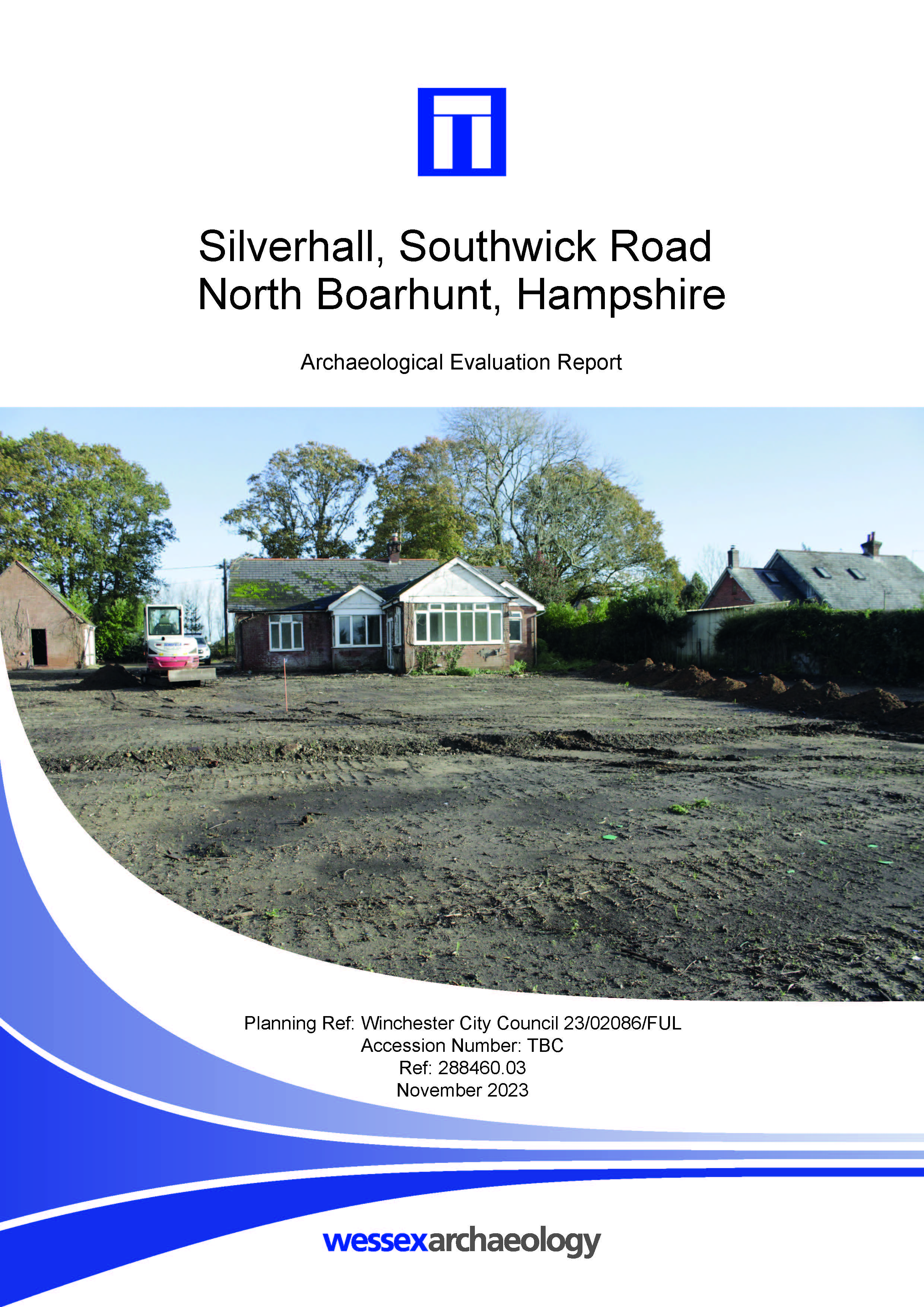
Silverhall, Southwick Road, North Boarhunt, Hampshire. Archaeological Evaluation Report
Published: 2023-11-01
Subjects: No Archaeology
Neither of the two excavated trial trenches contained archaeological features or deposits, with natural soil sequences being encountered within each of them. Overall, there seemed to be little truncation of the natural geology or the archaeological horizon. There was no evidence of the Roman road that is projected to run through this area of North Boarhunt.
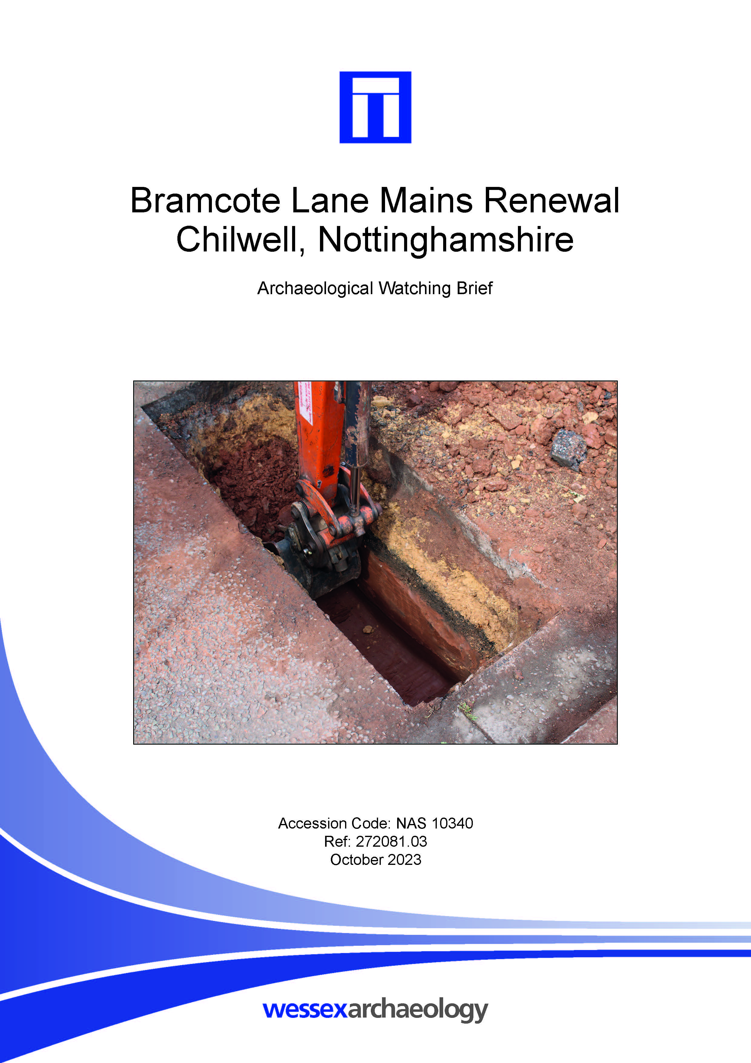
Bramcote Lane Mains Renewal, Chilwell, Nottinghamshire - Archaeological Watching Brief
Published: 2023-10-01
Subjects: Undated
Wessex Archaeology undertook an archaeological watching brief during the excavation of eight trial holes. The works were carried out to assess ground conditions in advance of the renewal of a water main that runs through Chilwell, Nottinghamshire. The monitored works were centred on NGR 450487 335713 and 451540 335530, at Chilwell, Nottinghamshire, NG9 5NP. The watching brief found no [...]
Ratcliffe Proposed Quarry - Detailed Gradiometer Survey Report
Published: 2023-10-01
Subjects: Geophysical Survey, Medieval Agriculture, Post-Medieval Agriculture, Undated Archaeological Features
A detailed gradiometer survey was conducted over one field which covered an area of 9.2 hectares. Linear and curvilinear anomalies were detected in the west of the site and likely represent the continuation of enclosure ditches or boundary features identified in a previous geophysical survey. Ridge and furrow agriculture was also present in the west and due to spacing and curvature was likely to [...]
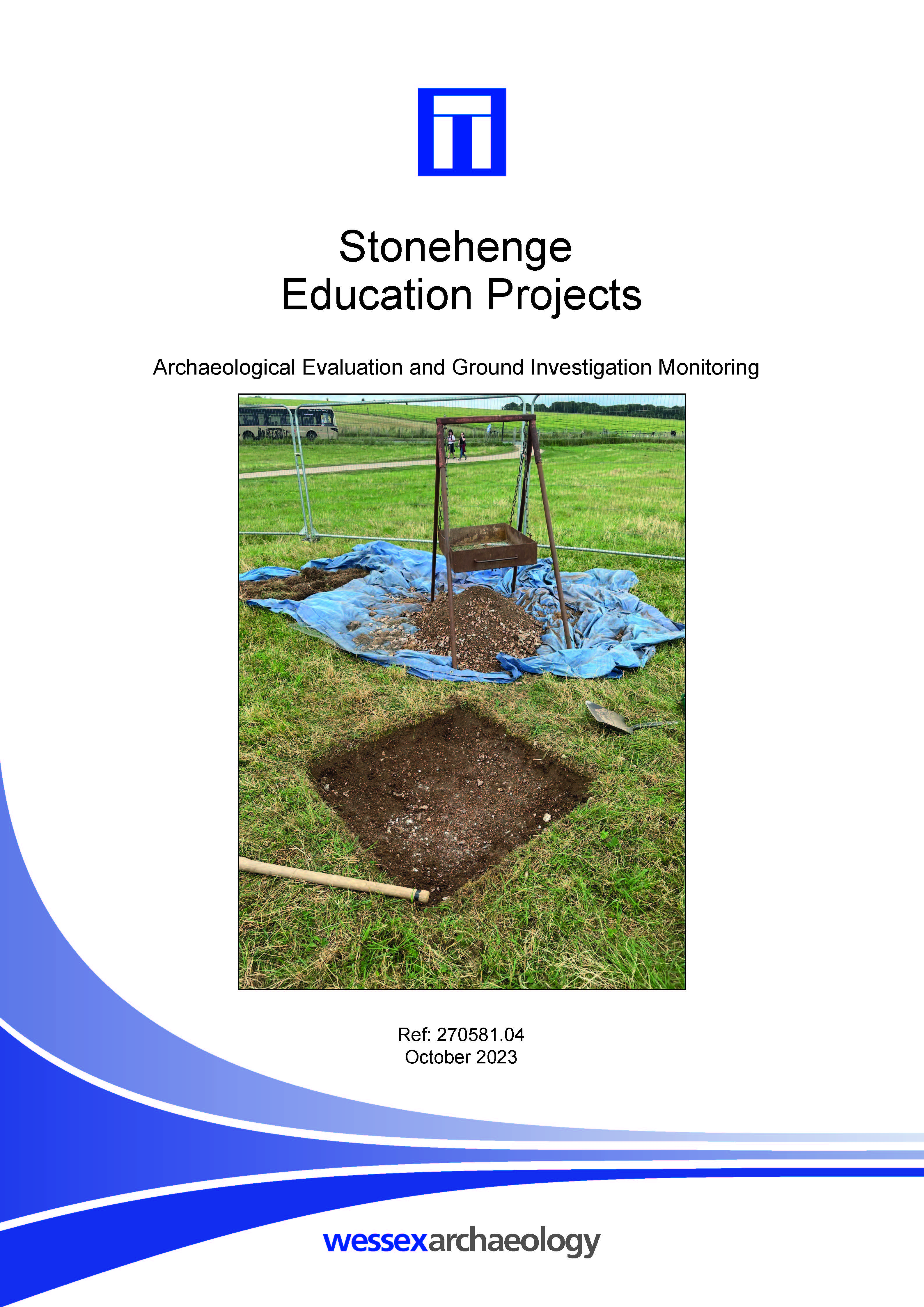
Stonehenge Education Projects - Archaeological Evaluation and Ground Investigation Monitoring
Published: 2023-10-01
Subjects: No Archaeology
An archaeological evaluation was undertaken on a 0.08 ha parcel of land located at the Stonehenge Visitors Centre, along with associated monitoring of localised ground investigations. The works encountered no archaeological features, deposits or artefacts, despite the potential of the site, which lies within the Stonehenge, Avebury and Associated Sites UNESCO World Heritage Site. The [...]
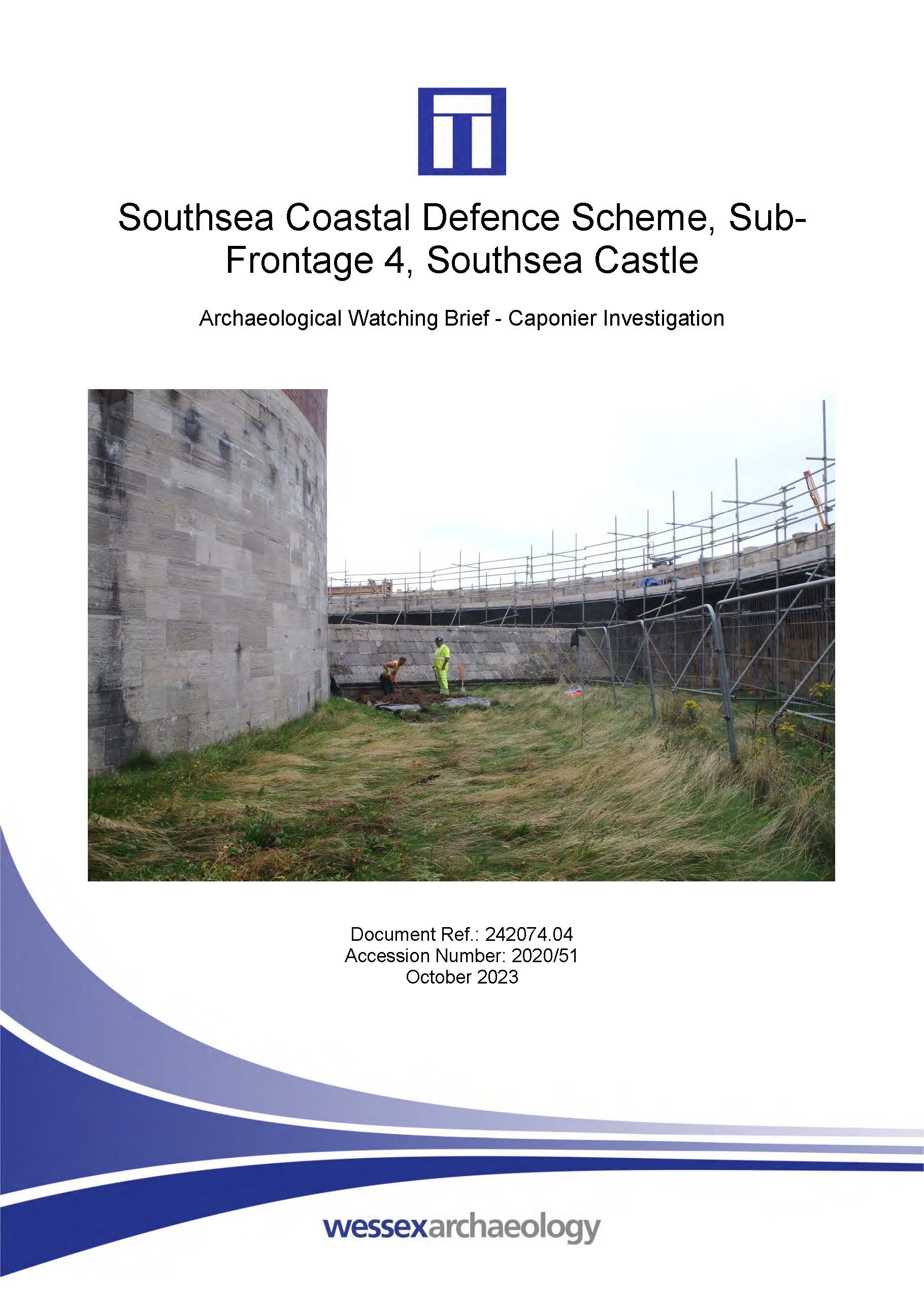
Southsea Coastal Defence Scheme, Sub-Frontage 4, Southsea Castle - Archaeological Watching Brief - Caponier Investigation
Published: 2023-10-01
Subjects: Historic Monument
The monitored test pit exposed the foundations of the caponier and the interior castle walls within the moat, allowing for their characteristics and depth to be recorded. No other archaeological features or deposits were identified within the test pit. The excavated material that forms the backfill of the moat dates to within the last century with no evidence of earlier phases of backfilling [...]
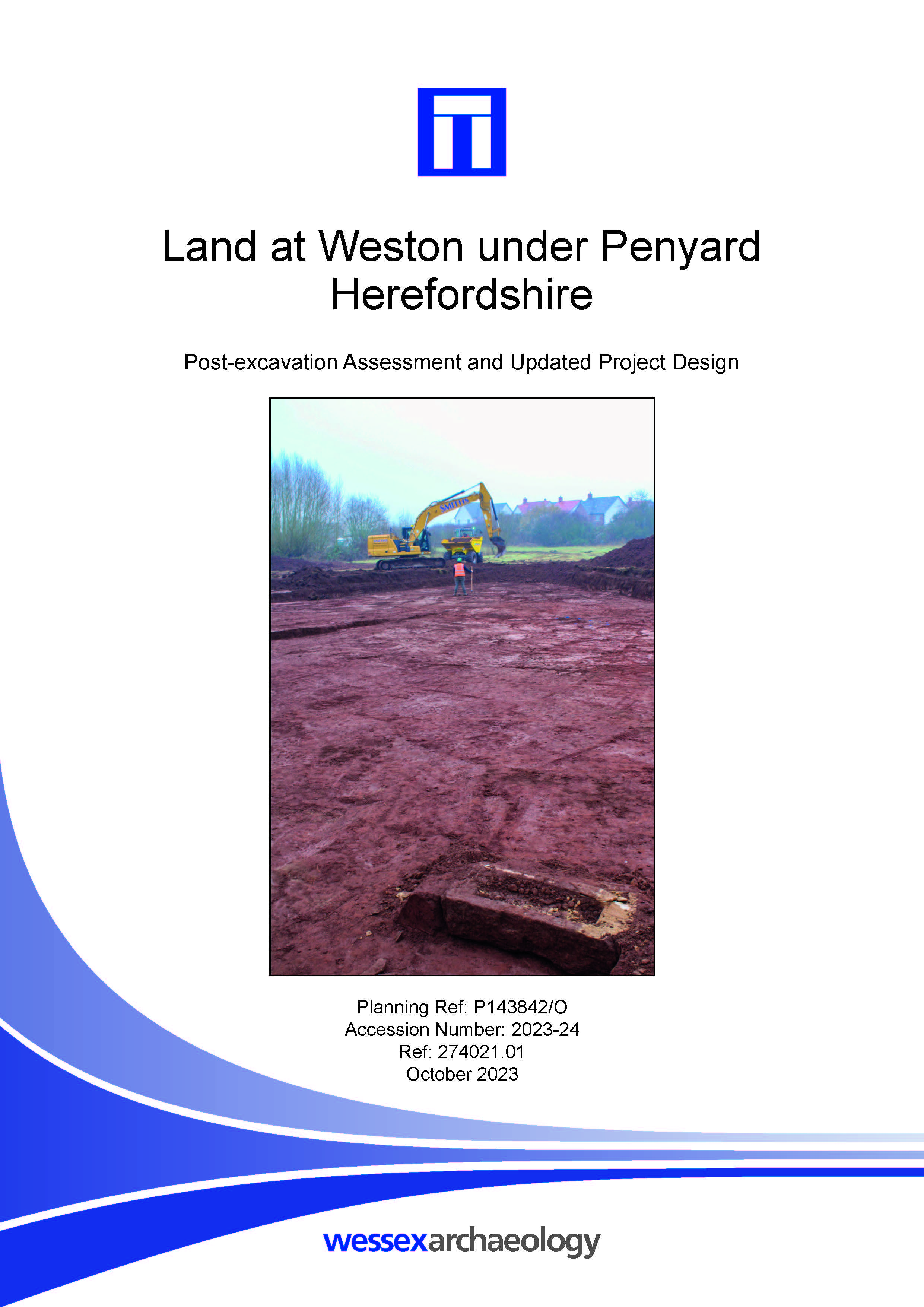
Land at Weston under Penyard, Herefordshire. Post-Excavation Assessment.
Published: 2023-10-01
Subjects: Romano-British Agriculture
The archaeological remains revealed in excavation Area 1 were limited and comprised a stone trough/repurposed coffin and two ditches that may relate to part of a former field system. The associated small assemblage of finds indicates a potential Romano-British date for the two ditches. Part of a north-east to south-west aligned stone drain of uncertain date was revealed within excavation Area [...]
Defensive Links: Burntisland's Military Past. Gradiometer and Ground Penetrating Radar Survey Report
Published: 2023-10-01
Subjects: Geophysical Survey, Modern Settlement, Post-Medieval Settlement, World War II
Weak parallel linear anomalies are noted across the site. The majority of these likely pertain to ditches, possibly archaeological in origin or perhaps modern drainage. A pair of parallel linear anomalies indicate roadside ditches associated with the former ‘Petty-cur and Kinghorn’ road displayed in the Elphinstone 1745 map. A former World War 2 air raid shelter marked on a map discovered in a [...]

Brookpit Lane, Climping, West Sussex - Detailed Gradiometer Survey Report
Published: 2023-09-01
Subjects: Geophysical Survey, Undated Archaeological Features
A detailed gradiometer survey was conducted over one field covering an area of 11.4 hectares. The gradiometer survey identified archaeological activity in the centre and south of the survey area which pertained to a settlement bounded by a ditched, and at points, double-ditched enclosure. A trackway ran through the centre, and further trackways were seen outside of the settlement. In the north [...]
Land at Twyford, Melton, Leicestershire - Detailed Gradiometer Survey Report
Published: 2023-09-01
Subjects: Geophysical Survey
A detailed gradiometer survey was conducted over a 14.1 ha parcel of land and was successful in detecting anomalies of possible archaeological origin: a possible ring-ditch, extraction pits and ridge and furrow cultivation were identified. The possible ditched enclosure was identified by a small cluster of curvilinear and globular anomalies which could also, however, represent geological [...]
Carmountside Crematorium, Stoke-on-Trent - Geoarchaeological Borehole Survey and Palaeoenvironmental Assessment
Published: 2023-08-01
Subjects: Geoarchaeology
A programme of geoarchaeological borehole survey, updated deposit modelling and palaeoenvironmental assessment was undertaken at Carmountside Crematorium, Stoke-on-Trent. Purposive geoarchaeological boreholes were targeted on peat and organic-rich deposits identified during the GDBA and previous GI works at the Site. Palaeoenvironmental assessment was undertaken on deposits of geoarchaeological [...]
Bramshill House and Park, Bramshill, Hampshire - Heritage Statement and Ground Penetrating Radar Survey Report
Published: 2023-08-01
Subjects: Geophysical Survey
A detailed gradiometer survey was conducted over land at Bramshill, Hampshire (centred on NGR 475765 159527). The site comprises parkland and grounds associated with the Grade I Listed Bramshill House, which lies within the Grade I Registered Park and Garden, covering an area of 1.43 ha. The ground penetrating radar survey has demonstrated the presence of a number of anomalies of potential [...]
Derwent River Wall Repairs, Matlock, Derbyshire - Photographic Recording and Archaeological Watching Brief
Published: 2023-08-01
Subjects: Undated
Wessex Archaeology was commissioned to undertake a programme of photographic recording and archaeological watching brief, with a ‘toolbox talk’, prior to and during emergency reinstatement works following the collapse of a section of a river wall in February 2022. The monitoring and recording covered approximately 50 m of riverside wall centred on NGR 429771 360239, at Matlock, Derbyshire, DE4 [...]
Embankment at Lydney Harbour, Lydney, Gloucestershire - Photogrammetric and Laser Scan Survey Report
Published: 2023-08-01
Subjects: Historic Monument, Modern Transport, Post-Medieval Transport
Wessex Archaeology undertook a photogrammetric survey of the approximate 1,500 m² of embankment and coal tips along the southern bank of the Lydney Canal. Lydney Docks and Harbour is scheduled by Historic England (NHLE 1002079) so Scheduled Monument Consent (S00243013) was needed. The survey comprised an Unmanned Aerial Vehicle (UAV) photogrammetric survey, supported by terrestrial [...]
Morden Bog, NNR Decoy Pond - Palaeoenvironmental Assessment Report
Published: 2023-08-01
Subjects: Geoarchaeology
A targeted geoarchaeological borehole survey was undertaken in and around the Decoy Pond at Morden Bog National Nature Reserve (NNR), Decoy Heath, Wareham. A total of 28 hand auger boreholes were undertaken using a Russian corer. Borehole WA-25a was selected as the master sequence for palaeoenvironmental assessment. A second borehole, WA-10a, was also radiocarbon dated for chronological [...]

Land off Longleaze Lane, Melksham, Wiltshire - Detailed Gradiometer Survey Report
Published: 2023-07-01
Subjects: Geophysical Survey
A detailed gradiometer survey was conducted over land at Land off Longleaze Lane, Melksham (centred on NGR 391390, 163102). The site comprises grassland located off of Longleaze Lane, covering an area of 0.7 ha. The gradiometer survey has not identified any anomalies that can confidently be interpreted as archaeology. A possible former field boundary identified in the southern portion of the site [...]